3D Geological Modeling
GeoExpo Global’s 3D Geological Modeling services provide a powerful tool for visualizing and understanding the subsurface geology of your project area. By integrating geological, geophysical, and geochemical data into a single cohesive model, we create detailed and accurate 3D representations of the subsurface, allowing for more informed decision-making in exploration, resource estimation, and mine planning. Our 3D models are designed to reduce geological uncertainty, optimize exploration and development strategies, and enhance the overall success of your mining projects.
Comprehensive Data Integration:
The foundation of effective 3D geological modeling lies in the integration of diverse datasets. At GeoExpo Global, we bring together a wide range of data sources, including drill core data, geophysical surveys, surface mapping, and geochemical analysis, to create a comprehensive geological model. Our multidisciplinary approach ensures that all relevant information is considered, resulting in a more accurate and reliable representation of the subsurface. This integrated modeling approach allows us to identify key geological features, such as fault zones, mineralized bodies, and lithological boundaries, that are critical to your exploration and development efforts.
Advanced Modeling Techniques:
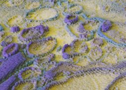
Our 3D geological models are created using state-of-the-art software and advanced modeling techniques. We employ industry-leading tools such as Leapfrog, GeoModeller, and GOCAD to construct detailed models that reflect the true complexity of the subsurface geology. Our modeling process involves the creation of wireframe models, block models, and voxel models that represent the geometry, grade distribution, and spatial relationships of geological units. These models can be easily updated as new data becomes available, ensuring that your project is always based on the most current and accurate information.
Visualization and Interpretation:
One of the key benefits of 3D geological modeling is the ability to visualize complex geological structures in three dimensions. Our models provide a clear and intuitive way to understand the spatial relationships between different geological features, making it easier to identify exploration targets and assess resource potential. We offer a range of visualization options, including cross-sections, isometric views, and interactive 3D models that can be manipulated and explored in real-time. These visualizations are not only valuable for technical analysis but also serve as powerful communication tools for stakeholders, investors, and regulatory bodies.
Exploration Targeting and Drilling Optimization:
3D geological modeling plays a crucial role in exploration targeting and drilling optimization. By accurately representing the subsurface geology, our models help you identify the most prospective areas for exploration and design efficient drilling programs. We use the models to predict the location and orientation of mineralized zones, optimize drill hole placement, and reduce the risk of drilling in unproductive areas. This targeted approach maximizes the efficiency of your exploration efforts, reducing costs and increasing the likelihood of discovery.
Resource Estimation and Reporting:
Accurate resource estimation is a critical component of any mining project, and 3D geological modeling is essential for this process. Our models provide a detailed representation of the distribution and grade of mineral resources within your project area, allowing for precise volume calculations and resource classification. We use the models to generate resource estimates that are compliant with international reporting standards, such as JORC, NI 43-101, and CIM. Our resource reports include detailed block models, grade-tonnage curves, and uncertainty analyses, providing a solid foundation for project valuation, financing, and development.
Structural Geology and Geotechnical Analysis:
Understanding the structural geology of your project area is vital for successful mine planning and development. Our 3D geological models incorporate structural data, such as fault planes, fold axes, and fracture networks, to provide a comprehensive understanding of the subsurface geometry. This information is essential for assessing the stability of rock masses, designing safe and efficient mine layouts, and predicting the behavior of ore bodies during extraction. Our models also support geotechnical analysis, helping you identify potential hazards and design mitigation strategies to ensure safe and sustainable mining operations.
Scenario Planning and Risk Assessment:
3D geological models are powerful tools for scenario planning and risk assessment. By creating multiple model scenarios based on different geological interpretations, we help you assess the impact of geological uncertainty on your project. These scenarios allow you to evaluate different exploration, development, and production strategies, enabling you to make informed decisions that minimize risk and maximize project value. Our models also support sensitivity analyses, helping you understand how changes in key variables, such as commodity prices or geological assumptions, may affect project outcomes.
Mine Planning and Development:
In the mine planning and development stages, 3D geological models are essential for designing efficient and sustainable mining operations. Our models provide the detailed geological information needed to plan mine infrastructure, optimize ore extraction, and minimize waste. We use the models to support pit optimization, underground mine design, and resource reconciliation, ensuring that your mining operations are both economically viable and environmentally responsible. Our models also facilitate the integration of geological data with mining software, enabling seamless transition from exploration to production.
Ongoing Model Updates and Maintenance:
Geological models are dynamic tools that evolve as new data becomes available. At GeoExpo Global, we offer ongoing model updates and maintenance services to ensure that your 3D geological model remains accurate and up-to-date throughout the life of your project. We continuously integrate new drilling data, geophysical results, and geological interpretations into the model, allowing you to adapt your exploration and development strategies in response to changing conditions. Our commitment to model maintenance ensures that you always have access to the most reliable geological information.
Training and Capacity Building:
We believe in empowering our clients with the skills and knowledge needed to leverage 3D geological modeling effectively. GeoExpo Global offers training and capacity-building programs that cover all aspects of 3D modeling, from data integration and model construction to interpretation and application. Our training programs are tailored to your specific needs and can be delivered on-site or remotely. By enhancing the capabilities of your team, we help you make the most of your 3D geological models, ensuring that they are used to their full potential in driving project success.
Global Expertise and Local Insights:
GeoExpo Global combines global expertise with local insights to deliver 3D geological modeling services that are tailored to the unique geological and operational conditions of your project. Our team has extensive experience working in diverse geological environments around the world, from complex mineralized terrains to stable cratons. We understand the specific challenges and opportunities in different regions and apply this knowledge to create models that provide actionable insights and support informed decision-making.
In summary, GeoExpo Global’s 3D Geological Modeling services offer a powerful and versatile tool for visualizing and understanding the subsurface geology of your project area. By integrating diverse data sets into detailed and accurate models, we provide the insights needed to optimize exploration, resource estimation, and mine planning. Whether you are in the early stages of exploration or advancing towards production, our 3D geological models are essential for reducing geological uncertainty, enhancing project value, and achieving successful outcomes.


